Visiting Puketāpapa

A Vibrant Tapestry of Neighbourhoods and Natural Landmarks
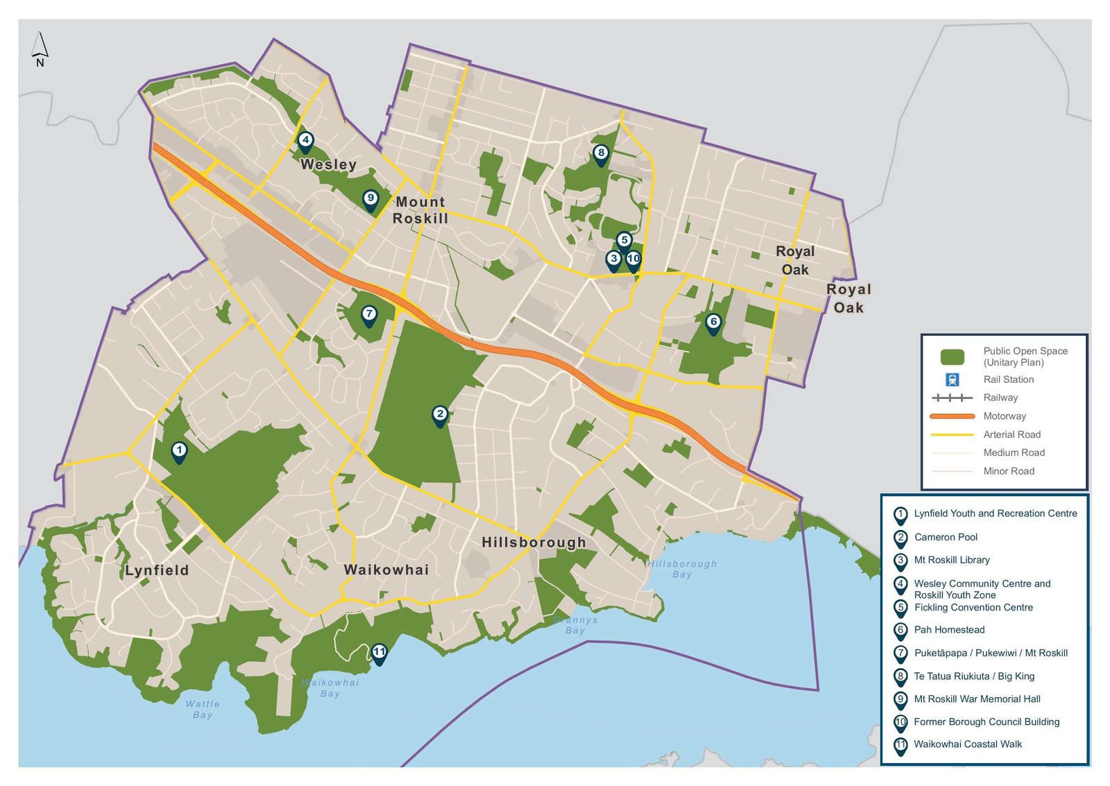
Landmarks & Areas of Interest
- Puketāpapa / Mt Roskill – Volcanic cone with scenic views.
- Te Tātua a Riukiuta / Three Kings – Another historic volcanic site.
- Monte Cecilia Park & Pah Homestead – Art gallery and heritage park.
- Keith Hay Park – Major sports and recreation hub.
- Waikōwhai Coastal Walkway – Beautiful coastal trail along the Manukau Harbour.
- Wesley Market – A popular community market.
- Lovelock Track – Historic running track used by legendary athletes.
- Lynfield Cove Reserve – A hidden gem for coastal walks.
- Greenways Network Paths – Connecting parks and reserves for walking & cycling.
- Roskill Youth Zone & Lynfield Youth Centre – Community activity spaces.
How to reach
Route 25B/25L
Route 27H/27W
Route 66,67 and 68
The Auckland Transport (AT) network also includes night buses, school bus routes, and special event services that may pass through or connect near Puketāpapa. You can explore detailed maps and stop-by-stop route planning via the AT Journey Planner:
Car Parks
Puketāpapa business areas have free and paid off-street and on-street parking options, including mobility parking, with a range of parking time options. Please be mindful of where you park and the time you need. Avoid being towed (for parking in a clearway or parking too close to a driveway) or earning a parking ticket (for overstaying the time allowance), which would spoil your visit. For more information on parking, please visit https://at.govt.nz/driving-and-parking/find-parking
Keith Hay Park (Mt Roskill)
- Large car parking available near the sports fields and Cameron Pool & Leisure Centre.
- Address: 63 Noton Road, Mt Roskill
- Great for events, sports, and family recreation.
Monte Cecilia Park (Hillsborough)
- Parking near the Pah Homestead (art gallery and café).
- Offers a scenic setting with views and a historic homestead.
Three Kings Reserve
- Car parks serve both the reserve and nearby facilities like the Fickling Convention Centre and Mt Roskill Library.
Margaret Griffen Park (Lynfield)
- Includes a children’s playground, sports fields, and is adjacent to Lynfield Leisure Centre which has its own parking.
All these parks are equipped not only with car parks but also playgrounds, sports facilities, and walking/cycling paths. For a full interactive map of Auckland parks (including car park info), you can use the official Auckland Council Park Map
For further accessibility or event-based parking considerations, Auckland Council’s OurAuckland article on Puketāpapa parks provides additional info ourauckland.aucklandcouncil.govt.nz